
Loch Neaton parkrun

While there are quite a few "L" events I could attend this week, including Lowestoft, Lingwood, Littleport, Luton Wardown, my research suggested that each of those events would be best attended in pleasant weather when I am able to spend the day exploring the nearby areas. Loch Neaton, however, seemed to be a smaller, more community-driven event, and likely less impacted by the weather as it's less of a tourist destination than others.

The area

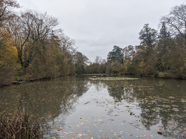
Loch Neaton is a recreation ground on the outskirts of the town of Watton, and home to Loch Neaton parkrun. The area is named after the Scottish Navvies who were instrumental in the construction of the local railway - many of whom settled in the area after construction was complete.

During the construction of the railways, the site served as an earthworks, supplying materials needed for the construction of a nearby embankment. The recreation ground itself was formed by filling the quarry to form a lake, which was used for swimming boating and fishing in its heyday. Swimming and boating are no longer permitted, but the immediately surrounding land has since been landscaped to create a pleasant space to unwind.

The 'loch' at Loch Neaton

The course

A short, sharp loop near the loch kicks off the course, followed by three laps of the football pitches, rounded out by another partial lap of the loch. Apart from a very short area on tarmac, the run is on grass and trail, and although unexpected, the course includes a good amount of elevation over the course of a gradual incline covered each lap.

Free parking is available on site, and toilets and a cafe are located in the sports centre.

View of the sorts fields

The run

Being an all-grass event, the moisture of the past few days made today's event more of a challenge than I anticipated. The gentle climb of the course didn't make the running any easier either!

Thanks to all of the marshals for a great event!

After the run

Following the run, I took some time to explore the town, which has a number of buildings. The first notable building is perhaps the clock tower which dates back to 1679, and is now encompassed by the main high street.

Watton Clock Tower

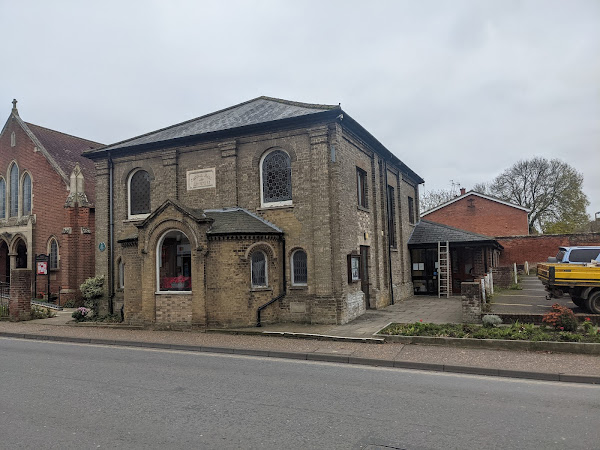
To the west of the town lies the Central Hall and Institute - a building dating back to 1874 as a schoolroom, and part of the Methodist chapel dating to 1829.

Central Hall and Institute

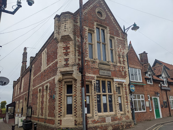
Near to the clock tower, and more centrally than Central Hall, lies the town hall known as Wayland Hall. Built in 1853 as a market hall, the building has served many purposes, including social gatherings, a courthouse, a library, and a library, before its current use as town council offices.

Wayland Hall

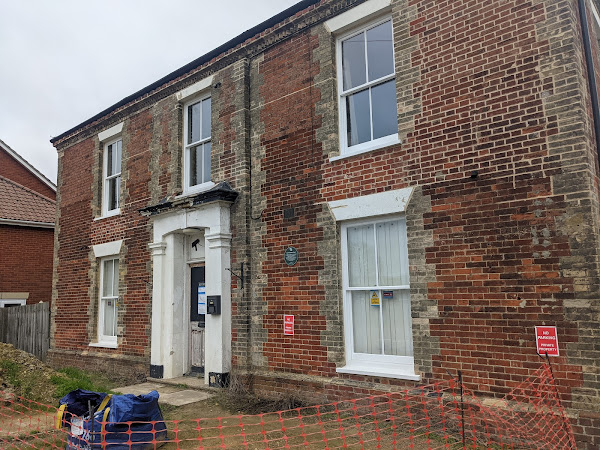
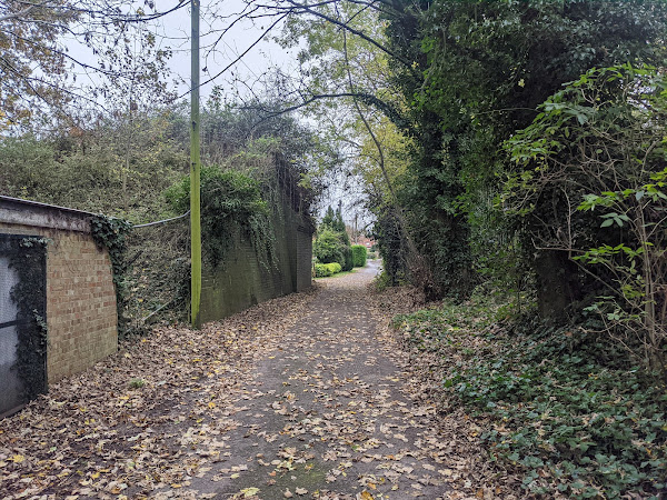
While the railway no longer runs through Watton, a number of artefacts still remain, including The Old Railway Hotel, and a number of abutments near the loch.

The Old Railway Hotel
Abutments for a now removed railway bridge

Links: Results | Strava

References: History of Watton (Central Hall and Institute) | History of Watton (Wayland Hall)

Popular posts from this blog

Mildenhall Hub parkrun

This week I decided to make some more progress on the Fibonacci Sequence challenge by attending event number 5 of the new Mildenhall Hub parkrun! The area Mildenhall is a small market town located between Cambridge and Bury St Edmunds. The modern town's population is heavily influenced by the two airforce bases located on the outskirts of the town, with up to a third of the town's residents being born in USA! The town is also where the Mildenhall Treasure was discovered - a collection of Roman silverwar considered to be perhaps the most important and valuable Roman treasure find in Britain. Owing to its importance and value, the treasure is now on permanent display at the British Museum. To the west of the town lies Mildenhall Hub, a newly built community centre, and host of this week's parkrun event! The course One lap of the course follows an initial out-and-back section, followed a lap of the adjoining meadow, with runners following the route two and a hal

Sloughbottom parkrun

With the weather reflecting a stereotypical British summer in the week prior to parkrunday (cloudy), I decided against attending one of the remaining seafront events this week. With a small island of unattended events in Norwich still, I couldn't fight the temptation to make that island smaller, and so Sloughbottom was to be this week's event! The area Sloughbottom parkrun (pronounced "slow-bottom" by the locals) is held in Sloughbottom Park, and the adjacent greenspace and former railway line in Norwich. The park is a recreation ground, and was created in 1929 as part of the council's efforts to kick-start the local economy at the same time as Eaton Park, which hosts Norwich parkrun . The former railway line which makes up part of the course is now known as Marriott's Way, a 24 mile trail path which follows the path of the original railway lines from Norwich to Aylsham. The trail is named after the former Chief Engineer and Manager of one of the f

Flegg High parkrun

After running Brighton Marathon last week, I was in desperate need of an easy recovery run this week, in all senses! Flegg High parkrun ticks all of the boxes I was looking for, in that it is a flat, small event, with some off-road surfaces to help with the recovery. The area Flegg High parkrun is hosted by Flegg High Ormiston Academy - an academy in the village of Martham, near Great Yarmouth, in Norfolk. The village of Martham is a primarily residential area, while also being home to Martham Broad - a nature reserve slightly north of the town. The course The route at Flegg High follows three laps of the perimeter of the school grounds, taking in the playing grounds as well as the school's playground. The course is run on many surfaces, including tarmac, gravel, and grass, but can best be thought of as 2-thirds off-road (mainly grass) and 1-third on-road (gravel and tarmac). Toilets are available in the school, and free parking is available on site. The run Tod