
Roding Valley parkrun

I was ideally in search of an "R" event this week, and as there are a couple of possible events (Roding Valley and Rickmansworth), my choice was largely based on attending the furthest event. Another factor was the size of the event (I would prefer a smaller event with a stronger sense of community given the time of the year) - Roding Valley typically only attracts a small field, while Rickmansworth's field is typically a very large one, so Roding Valley it is!

The area

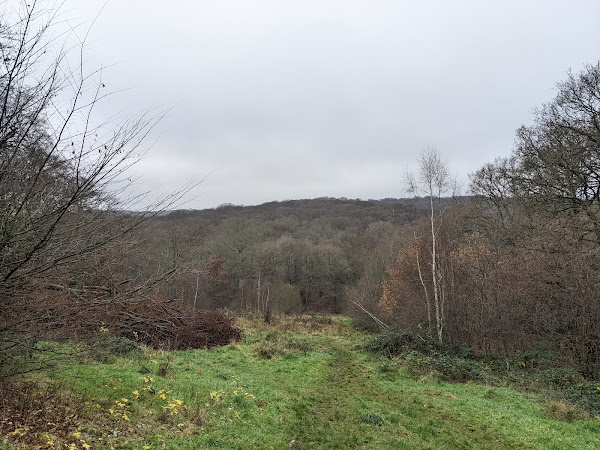
Roding Valley parkrun takes place in Roding Valley, near Epping Forest. Epping Forest is a former royal hunting grounds, stretching approximately 20 km north to south, but less than 5 km in width for the majority of the space.

Roding Valley is a geological valley to the east of Epping Forest, through which the River Roding flows.

The River Roding, at the boundary of the route

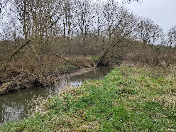
Much of the valley is meadows or grasslands, and acts as a floodplain. The area is grazed by cattle during drier weather.

The playing fields which form the main area of the course

The course

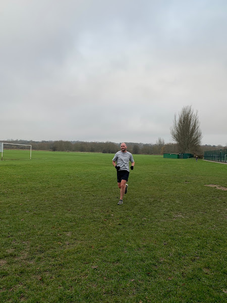
Runners follow two laps of a route around the perimeter of the playing fields over roughly half tarmac, and half grass. There is also a wooden bridge that runners cross, which can be slippy even in trail shoes.

The wooden bridge runners cross each lap

In wet weather, trail shoes are definitely recommended, as the ground can become muddy and saturated with water, but in dry weather, one would assume road shoes are fine.

There are no toilets within the vicinity of the event, although limited free parking is available in the car park near the start area, and on the local residential roads. I couldn't find any details of a cafe that runners attend after the event, although Loughton High Street is a short walk away, which houses a number of cafes.

The run

As soon as we set off today, I was glad that I had selected trail shoes! The grass was saturated, and the first (and most subsequent) corner consisted mostly of mud. As we joined the tarmac path which runs parrallel to the river, I was able to pick the pace up slightly, but I had already decided that this would be a steady effort, so I didn't overdo it.

Approximately half way around the route, we crossed a wooden bridge, which the marshal accurately warned would be slippery. The fact I was wearing trail shoes didn't seem to increase my grip at all.

The rest of the run was very smooth sailing, and I kept to my plan for this to just be a steady effort.

Ian running towards the finish funnel

Thanks to all of the volunteers for a fun event!

After the run

Following the run, I explored a small area of Epping Forest. The area is very lumpy, and would be a great place to run a long run in fairer weather, however, the ground was quite saturated today making running much higher effort.

A view over Epping Forest

The forest is often used as a film set. One very easily accessible such set is the Black Knight's bridge from Monty Python and the Holy Grail.

The Black Knight's bridge

Links: Results | Strava

Popular posts from this blog

Mildenhall Hub parkrun

This week I decided to make some more progress on the Fibonacci Sequence challenge by attending event number 5 of the new Mildenhall Hub parkrun! The area Mildenhall is a small market town located between Cambridge and Bury St Edmunds. The modern town's population is heavily influenced by the two airforce bases located on the outskirts of the town, with up to a third of the town's residents being born in USA! The town is also where the Mildenhall Treasure was discovered - a collection of Roman silverwar considered to be perhaps the most important and valuable Roman treasure find in Britain. Owing to its importance and value, the treasure is now on permanent display at the British Museum. To the west of the town lies Mildenhall Hub, a newly built community centre, and host of this week's parkrun event! The course One lap of the course follows an initial out-and-back section, followed a lap of the adjoining meadow, with runners following the route two and a hal

Sloughbottom parkrun

With the weather reflecting a stereotypical British summer in the week prior to parkrunday (cloudy), I decided against attending one of the remaining seafront events this week. With a small island of unattended events in Norwich still, I couldn't fight the temptation to make that island smaller, and so Sloughbottom was to be this week's event! The area Sloughbottom parkrun (pronounced "slow-bottom" by the locals) is held in Sloughbottom Park, and the adjacent greenspace and former railway line in Norwich. The park is a recreation ground, and was created in 1929 as part of the council's efforts to kick-start the local economy at the same time as Eaton Park, which hosts Norwich parkrun . The former railway line which makes up part of the course is now known as Marriott's Way, a 24 mile trail path which follows the path of the original railway lines from Norwich to Aylsham. The trail is named after the former Chief Engineer and Manager of one of the f

Flegg High parkrun

After running Brighton Marathon last week, I was in desperate need of an easy recovery run this week, in all senses! Flegg High parkrun ticks all of the boxes I was looking for, in that it is a flat, small event, with some off-road surfaces to help with the recovery. The area Flegg High parkrun is hosted by Flegg High Ormiston Academy - an academy in the village of Martham, near Great Yarmouth, in Norfolk. The village of Martham is a primarily residential area, while also being home to Martham Broad - a nature reserve slightly north of the town. The course The route at Flegg High follows three laps of the perimeter of the school grounds, taking in the playing grounds as well as the school's playground. The course is run on many surfaces, including tarmac, gravel, and grass, but can best be thought of as 2-thirds off-road (mainly grass) and 1-third on-road (gravel and tarmac). Toilets are available in the school, and free parking is available on site. The run Tod