
Alton Water parkrun

While I have been looking forwards to attending Alton Water parkrun for a while (it shared its inaugural run with Bury Field, which I attended), the fact that attending this week also gives me some more progress towards the Fibonacci sequence by ticking off a 13th event was enough to tip the scales in its favour this week.

The area

Alton Water is a reservoir, built to provide drinking water to the Ipswich area following water shortages in the 1960s by building a dam at the eastern end of the lowland, and allowing water levels to rise over the course of the next 10 years.

The dam at Alton Water

The area which was claimed by the reservoir, as well as today's surroundings are primarily farmland, punctuated by the occasional village.

Farmland north of the reservoir

The course

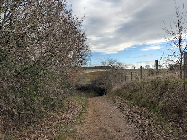
The two-lap trail course is run primarily on grass, with some gravel and dirt paths for good measure. The course is situated to the south of the reservoir, and offers views of the water, woodlands, and farmland, while cattle, geese and waterfowl are common sights along the route.

Toilets are available next to the cafe at the start/finish area, and discounted parking is available paying £1 in the cafe before you exit.

The run

While planning my trip today, I had to be conscious that storm Malik would play a part in today's events. Friday evening saw many events cancelled in anticipation of high winds, and being adjacent to open water, I did wonder whether I would need to redirect to another venue. Fortunately for me, the event team concluded that the run could go ahead!

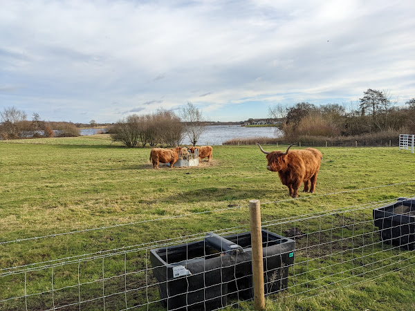
I had done a tough session during the week this week, and so I planned to have a relatively easy run today - the course agreed with my decision! The course was heavy under foot, and muddy in some parts, but the views over the reservoir provided a great distraction, as well as the oversight provided by the highland cows located in one of the fields we ran around.

Ian running with other athletes at the start of the event

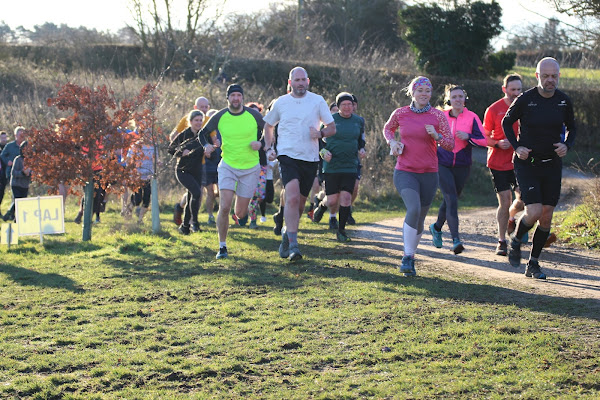
Thank you to all of the volunteers for such an enjoyable event on such an unseasonably warm but windy day!

Highland cows in one of the fields on the inside of the course

After the run

After the run I explored the reservoir, following the Alton Water Circular route.

As I embarked on my lap of the reservoir, the first sight was the dam, which extends several hundred metres.

Dam holding back water at Alton Water

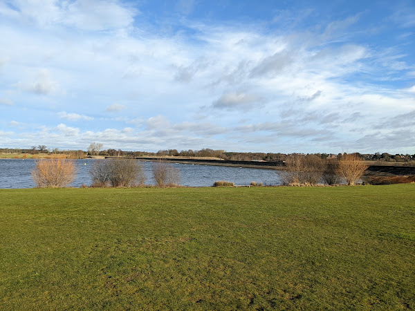
There were many opportunities to pause and absorb the setting along the route.

Southern view of the reservoir

It's worth keeping in mind that the reservoir is situated in a valley however, and the path follows what would have effectively been the ridgeline of the valley, leading to some very steep ascents and descents - sometimes you couldn't even see the path of the descent from the top of the hill!

Descent path not visible from the top of the hill

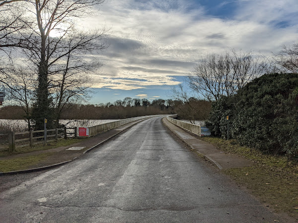
Towards the northern end of the loop, you cross over a bridge, which forms the vast majority of the tarmac and pavement you will encounter on this loop.

Bridge over Alton Water

As I was heading back towards the car park, there was one final opportunity to check in with the Highland cows.

Highland cows eating in the field

If you're planning on visiting, don't forget to pay for your parking before you head towards the exit - I only remembered as I was getting back to my car!

Ian with the cows

Links: Run report | Results | Strava | Alltrails (Alton Water circular)

Popular posts from this blog

Coldham's Common parkrun

As my recovery from injury is still underway, I decided that I would attend a flat course this week to avoid any potential for reaggrevation. Unfortunately this means I will need to pause my completion of the Essex events, as the remaining courses are all somewhat lumpy. Having visited all of the other Cambridge parkruns, including Storeys Field parkrun, Fulbourn Hospital parkrun, and Cambridge parkrun knowing that they are all relatively flat, I decided that this week I would complete the Cambridge set. The area Coldham's Common has a long history, serving as both a hospital during the 17th century smallpox outbreak, and a quarry during the 19th century, as well as a rifle range also during the 19th century. The course The route follows two laps of the perimeter of the common through an hour-glass shape, connecting two fields through a five-bar-gate. The course is all on grass, and is all flat. Limited parking is available nearby, while toilets are available in

Aldenham parkrun

Icey conditions in days leading up to parkrun day meant many events were cancelled this week. While I would have ideally been able to visit another event in Essex, I decided that I valued having options more in the event of cancellation this week, and so I instead headed to the cluster of events surrounding the Watford area. The area Aldenham Country Park is located near Watford, and centres on Aldenham reservoir, with grassland and woodland surrounding the reservoir itself. The reservoir was excavated by French prisoners of war during 1795 as part of the wider management of the Grand Union Canal's water levels, and now serves as a reserve water supply. In addition to the reservoir, the country park also supports the breeding of a number of rare species of farm animals, including cattle, goats, pigs, and sheep. The course The course follows two laps of the reservoir, with the second lap skipping the inner peninsular. The course is flat, and is run mainly on trail pat

Markshall Estate parkrun

Having spent a number of weeks focussed on events in the north of the East of England, I decided that this week I would pay some attention to the south of the region and visit Markshall Estate parkrun while still in the best time of the year to visit an arboretum. The area The Markshall Estate (interchangably the "Marks Hall" Estate) is the remains of a former country estate located in Coggeshall, between Colchester and Braintree. The hall itself was demolished in 1950, leaving its grounds to be converted into an arboretum, featuring trees from around the world. Coggeshall has been a settled area since at least the Saxon area, and was later served by Stane Street; a Roman road stretching from modern day Colchester to near St Albans. The course The route follows just under two laps of the arboretum, starting at the top of a hill, and finishing at the bottom, meaning this is a net down-hill course. The course is run on a mixture of tarmac, concrete, gravel, trail an